What I did was fairly easy enough. I loaded up the .kml file that I used to create the earlier photoscenery. (It's called Area_KML.kml because FSEarthTiles needs it to be called that). The kml files had two polygons in it, one called 'coast' which marked the shoreline and one called 'DeepWater' which marked the edge of the blendmask. All I did was to add some more polygons called 'Coast' to the Area_KML file, as you can see on this screenshot below. You can see Elizabeth Castle Island to the far left of the image, separately outlined in red.
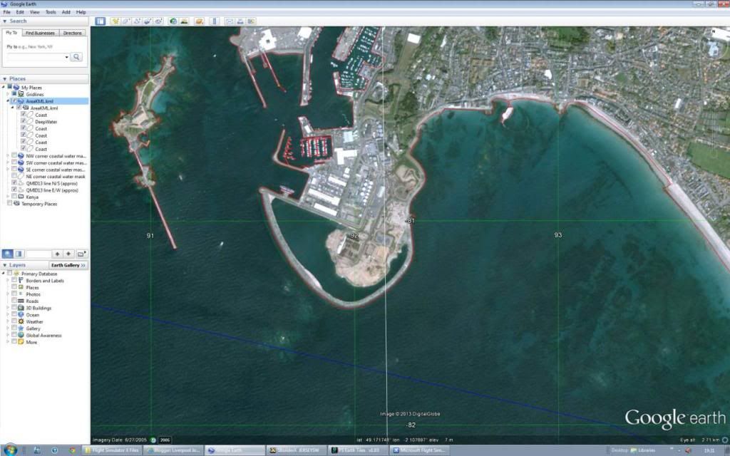
Every little islet will eventually have its own polygon named 'Coast'. When the photoscenery is compiled these will all come out as little islands, but for the purposes of this demo I am only doing Elizabeth Castle Island itself.
However, that isn't all I've had to do. The watermasks I created earlier need to be amended as well. This was a simple task. All I had to do was copy the new 'Coast' polygon I created earlier into the relevant kml file defining the QMID11 water mask. If you remember, I created this earlier for the initial test.
I ran this through PreFsxKml.exe to correct the kml file (just as before), then created the .shp file again in FSX_KML so that I could import it into SbuilderX. The new polygon complete with island was imported into SBX perfectly.
Using the hole technique (described in some detail in this page: http://www.newsite.fsdeveloper.com/forum/showthread.php?p=129440) I added the island to my existing water mask. Beware though, there is one little stage missed out from this otherwise excellent tutorial! When you select your island polygon and click 'make as hole' you then need to click on the polygon tool before clicking on the main parent polygon... I spent a good half hour figuring this out. Whoops!
(In SBX, remember to also add a landclass to the new island as well otherwise it won't be solid.)
So, just to recap...
- I amended the main kml file to include the island in Google Earth.
- Then I included that amendment to the watermask kml file in Google Earth again.
- I compiled the new main coastline file to create landclass, and the new watermask file to create the updated water, both in SBuilderX, (after running the updated kml files through PreFsxKml and FSX_KML.)
- I then compiled the photoscenery again using the amended main kml file in FSEarthTiles.
No comments:
Post a Comment